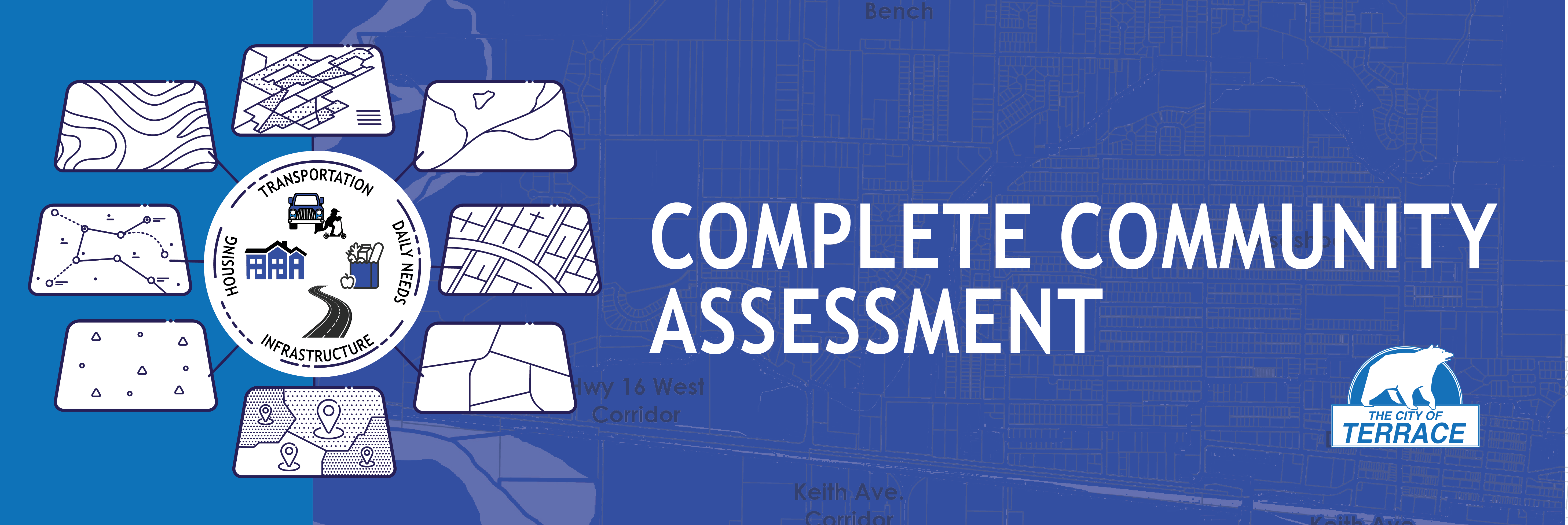
Complete Community Assessment
The City of Terrace is working on a Complete Communities Assessment that analyzes Terrace through the following lenses and proposes recommendations.
- Housing
- Daily Needs
- Transportation, and;
- Infrastructure
This is in anticipation of future growth, to address current and emerging needs in the community, and in response to new BC provincial land use legislation.
Deliverables from this assessment include baseline data and maps and future growth scenarios that will inform the Official Community Plan (OCP) Update.
What is a Complete Community?
A “complete community” is one that provides a diversity of housing to meet identified needs and accommodates people atContinue reading
-
Assessment results & final report now available
Share Assessment results & final report now available on Facebook Share Assessment results & final report now available on X (formerly Twitter) Share Assessment results & final report now available on Linkedin Email Assessment results & final report now available link
The Complete Communities Assessment Final Report, was presented to Council on March 10, 2025, and is now available to view and download.
The report explores actions to address community needs and current gaps in the city's levels of completeness. It outlines potential policy actions for consideration in the city's Official Community Plan (OCP) Update.
The report will help guide discussions on potential changes to land use designation for increasing housing density in and adjacent to the downtown core. These discussions are part of the OCP update.
The 203-page final report has a LOT of information in it. TheContinue reading
-
Open House materials available for download
Share Open House materials available for download on Facebook Share Open House materials available for download on X (formerly Twitter) Share Open House materials available for download on Linkedin Email Open House materials available for download link
 Download the Open House booklet!
The booklet includes all the poster boards and info that will displayed at the November 7 open house. Review the booklet in advance so you are ready to ask questions and give feedback. Or, for those who cannot make it, here's your chance to review the materials send us any feedback or questions to: developmentservices@terrace.ca
Photo: Sneak peak of just some of the info in the booklet, that we'll be presenting.
Hope to see you at the Complete Communities Assessment Open House!
- Thursday, November 7
- 4:30pm - 8pm
- at the Sportsplex Banquet Room (3220Continue reading
-
Join us! November 7 Open House
Share Join us! November 7 Open House on Facebook Share Join us! November 7 Open House on X (formerly Twitter) Share Join us! November 7 Open House on Linkedin Email Join us! November 7 Open House link

It's time to present our findings and get your feedback.
Join us at an Open House!
- Thursday, November 7
- 4:30pm - 8pm
- at the Sportsplex Banquet Room (3220 Kalum Street)
- Format is drop in.
Learn more about the Complete Communities Assessment, review the growth scenario maps, and share your feedback on recommendations.
Download the Open House booklet!
The booklet includes all the poster boards and info that will displayed at the open house. So you can review it in advance, and be ready to ask questions and give feedback. This also provides an opportunity for those who cannot makeContinue reading
-
Step 4 - Analyze Data and Future Growth Scenarios
Share Step 4 - Analyze Data and Future Growth Scenarios on Facebook Share Step 4 - Analyze Data and Future Growth Scenarios on X (formerly Twitter) Share Step 4 - Analyze Data and Future Growth Scenarios on Linkedin Email Step 4 - Analyze Data and Future Growth Scenarios link Read the What We Heard report from Round 1 of engagement
On Wednesday, March 13, an in-person public open house was held at the Days Inn, from 4:30–8:00 pm, where attendees were encouraged to review display boards, speak with facilitators, and browse the additional map booklets. Throughout the evening, most who attended stayed for a prolonged period (30 min+), taking time to speak to multiple facilitators about a range of topics.
Feedback was collected during the meeting through sticky notes as well as optional feedback forms.
Over 60 people attended the public open house to discuss the Complete Community AssessmentContinue reading
-
Step 3 - Project Open House
Share Step 3 - Project Open House on Facebook Share Step 3 - Project Open House on X (formerly Twitter) Share Step 3 - Project Open House on Linkedin Email Step 3 - Project Open House link Join us on March 13, 2024, from 4:30-8:00 pm at the Days Inn Banquet Room to learn more about the Complete Communities Assessment, view the baseline information maps, and ask questions to the project team.
Provide feedback on the maps using this form. You may drop it off at City Hall or the Public Works building.
-
Step 1 - Gather and Prepare the Data
Share Step 1 - Gather and Prepare the Data on Facebook Share Step 1 - Gather and Prepare the Data on X (formerly Twitter) Share Step 1 - Gather and Prepare the Data on Linkedin Email Step 1 - Gather and Prepare the Data link Over the past couple of months, the City has been working with Stantec Consulting, to kick off this project by reviewing existing data, plans, and studies. This information will be used to develop the baseline mapping in Step 2.
 -
What is a Complete Community?
Share What is a Complete Community? on Facebook Share What is a Complete Community? on X (formerly Twitter) Share What is a Complete Community? on Linkedin Email What is a Complete Community? linkWhat is a complete community?
A “complete community” is one that provides a diversity of housing to meet identified needs and accommodates people at all stages of life. Complete communities provide a wide range of employment opportunities, amenities, and services within reasonable walking and cycling distances of people’s homes. They also support the efficient use of infrastructure through more compact forms of development and promote the reduction of a community’s greenhouse gas (GHG) emissions through the provision of alternative modes of transportation and movement for residents.
Striving to become a more complete community is intended to operate as an overallContinue reading

Who's Listening
-
Project Management